It's only 7 days until I fly to Delhi, and I'm in a frenzy of last-minute preparations. I have to write one final pointless report for work, clean out my apartment, drive my posessions south to Oyama to my friend Nick's house for storage, get the last bits of information and addresses that I need for the trip ready, and then ride south to Narita airport. It's about 260 km and it will be a much-needed warm-up for this trip.
I feel woefully underprepared for this trip: fat, lazy and out of shape. I was forbidden from riding to work by fascist busybodies for whom I work, and the result has been far less cycling than I'm used to. It baffles me that in Japan, this sort of ridiculous intrusion into an employee's personal life is normal and almost expected. The official reason for forcing me to ride the bus to work is that it's "dangerous" for me to ride. The fact that I've ridden 30,000 km on bike tours around the globe in perfect safety cuts no ice with them. Apparently, the little-travelled, paved, wide road that leads 10 km from my apartment to work is far more dangerous than, say, the Howrah Bridge in Calcutta, or the Grand Trunk Road in Pakistan. It would be a perfect warmup for a day of sedentary activity to gain 400 vertical metres before work, and then to zip downhill at the end of the day. Instead, I sit, crammed into tiny Hobbit-sized seats in a crowded stuffy bus, getting slightly carsick from the turns. As a gesture of liberty, I'm riding my bike to work this afternoon, so that I can see how my new chain, gear-shift cable, pedals, tires and front wheel behave.
Anyway, I can't wait to put a winter of laziness, stress, tsunamis and really grim jobs behind me and find the liberty of the mountains again. I may or may not be invited back to work here (we're told 2 weeks before the start date whether we're needed or not; makes you feel really loved and respected), and if I don't, I'll just have to keep riding and hiking in India, Bangladesh and Burma instead.
So this is the plan for the summer's travels. It's another XTreme Dork misadventure, featuring three of the original Dorks: myself and my sisters Audie and Saakje. It's an all-too-short cycling/hiking/climbing trip to the Indian Himalayas, specifically to the far northern bit of India: Lahaul and Ladakh. I've been to the mountainous bits of Pakistan, China and Tibet that enclose this area, so it will plug a big hole in my personal map of the Himalayas. I'm going to add the text of a big prospectus I wrote while trying (unsuccessfully) to induce friends to join the trip after this, so those of you interested in details can read on, while the rest of you, dear readers, should feel free to ignore the rest. Talk to you all later.
Graydon
Cycling the Indian Himalaya
Another Xtreme Dork (Mis-)Adventure
The basic idea: To ride mountain bikes from the Indian lowlands up into the lunar Tibetan landscape of Lakakh to see some scenic bits, then to climb a wee peak and take a brisk stroll south from Ladakh back to the plains.
The team: Three of the Hazenberg siblings (Graydon, Audie and Saakje) and anyone else misguided enough to want to join in.
When: July and August, 2005.
Rendezvous: Manali, India, July 16, 2005
Finish Date: Audie and Saakje have to leave by August 27; Graydon may or may not continue later than this, depending on jobs and similar sad necessities. That’s about 7.5 weeks in total.
Costs: Aside from airfare to Delhi, very inexpensive. Perhaps US $10 a day (tops) while cycling and maybe $15 a day while trekking? If you budget $1000 for the whole trip, you should have plenty of cash left over. We will be staying in cheap guesthouses or camping while cycling and camping while climbing and trekking, so our only expenses should be food, pony rental (for trekking) and local transport to and from Delhi.
Visas and permits: Everybody needs either a 3-month or (preferably) a 6-month Indian tourist visa. Check out the situation on getting Indian visas wherever you are. Most places, if you’re not in your home country, there’s an annoying “telex fee” to your home country to see whether or not you’re a criminal. Usually the time on the 6-month visa starts ticking the moment you receive the visa, while the 3-month only starts when you enter India; so, if you’re going for the 6-month visa, don’t apply too far in advance. Make sure that your passport is valid until at least the end of 2005; otherwise get a new passport before applying for the visa. The 3-month is single-entry only, while the 6-month is multiple-entry.
We also need permits to visit Tso Moriri (although see next paragraph), Pangong Tso and Nubra, but we can get them in Leh. If we ride Kinnaur-Spiti-Lahaul, too, we will need an Inner Line Permit (checkpoints in Sumdo, Yangthang, Jangi) which we can get in Kaza (if riding north) or Rekong Peo (if riding south). For both of these, we need lots of passport-sized photos (possibly 10 in total), which you can either bring with you (look into taking a digital photo and printing off an A4 sheet of 30 or so small photos), or have them done in Delhi pretty cheaply).
From the Lonely Planet Thorn Tree: “For Tso Kar you don't need permit, since it is just a few km out of main road. We first went to Tso Moriri and I remember that on Mahu bridge you have to pay a small fee. If you tell them you are student it is like 5 Rp or something. Don't even remember, cause it was so cheap. But I don't remember if we needed permit for Tso Moriri. Well, around Tso Kar you certainly don't need it.”
If we don’t need a permit, or can avoid the checkpoints, we could incorporate a trip to Tso Moriri into the main Manali-Leh ride—see the second Corax itinerary below.
Guide Books:
Lonely Planet Indian Himalaya.
Lonely Planet Trekking in the Indian Himalaya.
Hugh Swift: Trekking in Pakistan and India.
John Keay: When Men and Mountains Meet: Explorers of the Western Himalaya.
It would be nice to have a copy of both of the LP guides. Hugh is amusing and ideosyncratic. John Keay’s book is good background reading, but it’s heavy to carry around.
Maps: Obviously a necessity (as Xtreme Dorks will attest to after the KKH to Kailash navigational fiascos). It would be nice to have a couple of different ones. If anyone sees these ahead of time, snap it up and let me know so that we don’t buy too many copies of the same map. Here are some possibilities.
Nelles Maps: Northern India, 1:1 500 000
Nest & Wings Baspa Maps: Kinnaur, Spiti and Lahaul Valleys (on sale in Delhi)
Lonely Planet Road Atlas of India and Bangladesh (big and heavy)
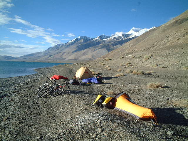
Food and Accommodation: From the Lonely Planet’s Thorn Tree: “There's accommodation along most of the route (ranging from hotels in Keylong to parachute tents in Patseo and Pang). A few cyclists don't bother with camping kit, but going without ties you into some long, hard days between food & sleeping stops. Anyway, the camping is spectacular, so I'd definitely recommend it if you don't mind lugging the kit.
Food wise, it's pretty good. You can stock up on pasta etc in Manali, then again at Keylong, whose bazaar has plenty of dried fruit, nuts, veg etc. Between Keylong and Upshi is the only stretch where things start getting remote - though there are still dhabas (roadside cafes - usually a kerosene stove, a couple of packets of biscuits and maybe a couple of eggs for whipping up an omelette). Parachute tents are qute a local institution - same as dhabas, just in an ex-army parachute. There are usually rocks with rugs laid down on them which you can kip on for Rs20-50 (25-60p)”.
Bike Shops in Delhi: (for last-minute panic purchases). From the Thorn Tree: “When you go from Pagarganj to the Red fort, you are passing through Chandni Chowk and a few hundred metres before you reach the Fort, there is a side road on your right. There are about 10 cycle shops there.”
Photography Shop in Delhi: Kinsey Bros; Connaught Place A-2, New Delhi
Itinerary:
(Manali-Leh direct)
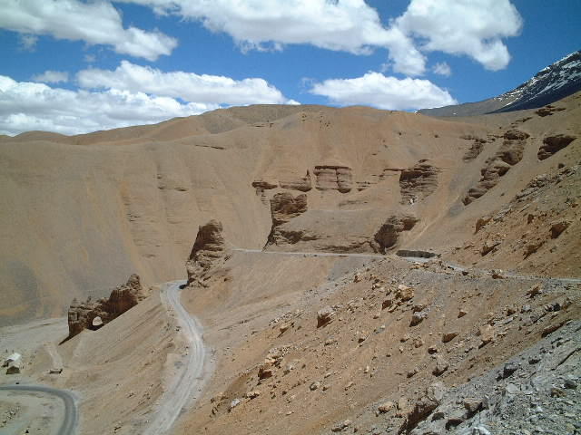
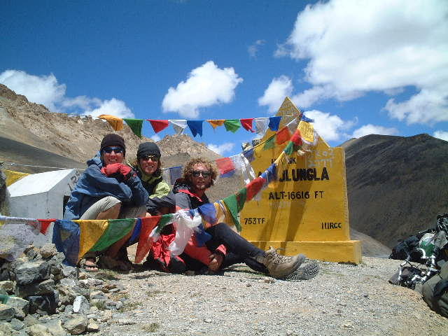
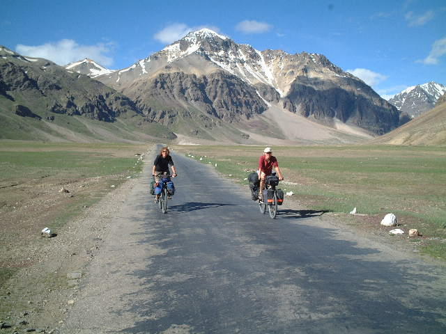
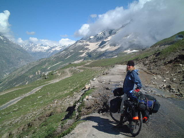
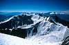
July 18-25: 8 days?: Ride Manali-Leh. It’s 478 km (see charts in Appendix), with 5 major passes, the highest 5360 metres high. To compare it to some other roads covered by XTreme Dork expeditions in the past, it’s most similar in length, height and number of passes to the first half of the Kargalik-Ali “road” in Western Tibet. The road will be mostly unpaved, but at least there’s more food available than in Tibet!
July 26-28: 3 days: Relax and congratulate ourselves in Leh, celebrate Audie and Saakje's birthday, take some pictures, eat a lot of food, get some permits processed.
July 29-Aug. 1: 4 days: Ride north over what’s claimed to be the highest road pass on earth (Khardung La, 5602 m), the first stage of the ancient caravan trail to Kargalik and Yarkand via the Aksai Chin plateau (the Xtreme Dorks rode the second half of this route, on the Chinese side of the border in 1998), check out the Nubra Valley, back to Leh. (see first route notes below).
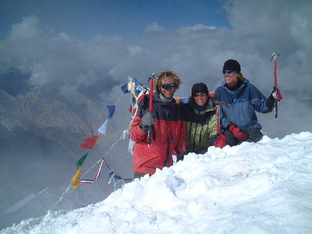
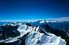
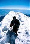
August 2-5: 4 days: Climb Stok Kangri (6121 m), a trekking peak just outside Leh. After all this time at high altitude, it should be a doddle, as we’ll be as acclimatized as we’ll ever be. We can apparently do it without a permit, and we can rent axes and crampons in Leh.
Aug. 6-10: 5 days: Ride either to Pangong Tso or Tso Moriri, two high-altitude alkaline lakes east of Leh. Both are spectacular, with good chances, particularly with Tso Moriri (see second chart below for kilometres to Tso Moriri: 211 km one way) , of seeing Tibetan wildlife—kiang (wild ass), gazelle, antelope—and Tibetan nomads. I’d prefer to go to Pangong, as we rode along its Tibetan shore in 1998, but I’m open to persuasion.
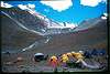
August 11-25: 15 days: Trekking Leh-Padum(capital of Zanskar Valley)-Darcha. This should be a spectacular trek across the Zanskar Range and the main Himalaya range back down to the Leh-Manali road. We’ll have to hire ponies to carry food, since, unlike Nepal, there aren’t tea houses along the way. This is particularly true if we take the less-travelled of the two treks from Ladakh to Padum (over the Cha Cha La). This should be a real highlight of the trip. What to do with the bikes? We can either pack them into a couple of jeeps and send them to meet us in Darcha, or we can partially disassemble them and load them onto ponies, as other cyclists have done. I don’t know which sounds scarier!
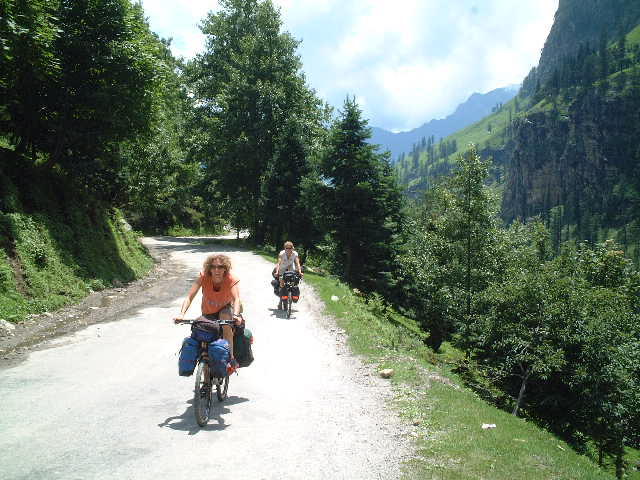
August 26-28: 3 days: Riding south from Darcha to Manali and getting back to Delhi from there by bus or jeep.
August 28-September 8: 12 days (optional add-on): If anyone is staying longer, we can ride east from the Rohtang Pass into Lahaul, Spiti and Kinnaur for another 2 weeks or so, ending up in Shimla. The scenery is supposed to be sublime, with more Tibetan culture and scenery in Lahaul and Spiti (Spiti is just down the Sutlej River from Lake Manasarovar and Tirthapuri, and has one of the most important monasteries in the world in it) and green, forested slopes in Kinnaur.
That comes to 49 days, or 7 weeks, not counting the optional return loop through Lahaul and Spiti. Of course, a lot of these day totals are guess-timates, but the trekking total should be pretty accurate, and the cycling times shouldn’t be too far off.
From the Thorntree:
There's only one permanent landslide in Kinnaur & Spiti and that's at Malling, between Nako and Tabo. There's a pulley system which operates across it, and you can send your bike over for a few rupees, and yourself - if you're feeling brave. Most people walk across the slide area. There are two routes - one which takes 35-40mins, and a longer, safer one which takes about 90mins. Follow the locals - though you might be hard pressed to keep up with them over the rocks.
You may hear that people have jeeped across Malling - this is true, but they use a higher road which is only drivable until the end of March, when the snow and ice starts melting and the mountain becomes unstable again.
Apart from Malling, there are usually smaller landslides throughout the area in summer. Kinnaur is particularly prone, and it can take the army a day or two to clear the roads. We hauled our bikes over a couple. It's not a pain in the ass, and locals will usually offer to help. Think twice before handing over panniers though - it's not unknown for things to be removed from them once you're out of sight. The big advantage of slides is traffic-free roads.
If you see a bloke by the side of the road with a red flag on a stick, there'll be dynamiting ahead. Makes sure he sees you before you whizz past - a few cyclists have found themselves running a gauntlet of explosions and falling rocks after ignoring him!
This is from 2003 & 2004 - hope it helps.
After this ride, if I’m not working in September/October, I’m also thinking of riding in Arunachal Pradesh (if I can swing a permit), Bangladesh and Burma. Another possibility is to return to Iran and finish the Silk Road Ride by riding through the Caucasus republics en route to Eastern Turkey. Company would be welcome on these possible adventures, too.
Equipment:
Those of you who have done a big bike trip before can ignore this. This section is for those of you new to bike touring on crap roads up big mountains in the back of beyond.
Basically you need to have biking gear on top of ordinary trekking and camping gear. It adds up to a lot of weight, so you need to have a strong bike with strong racks and strong rims and hubs. This is the basics on what to have/buy/look out for.
Bike: Much of the trip is on rough dirt roads, so a mountain bike frame with strong 26-inch wheels is best. You don’t need a fancy mountain bike, but a good brand name like Rocky Mountain, Giant, GS, Marin, Specialized, Trek, Gary Fischer or the like is a good idea. Try to get one set up with touring in mind. It’s far easier to put luggage racks on front forks without front suspension shocks, but those are tough to find. Important: make sure there are bolt holes for attaching luggage racks on the back and front forks, and on the frame behind/below the seat! Talk to the bike shop to make sure that luggage racks can be attached to the bike.
I spent about $550 on my Rocky Mountain Sherpa, and this is about the minimum for a bike that will last. Make sure that the bike has strong rims: double rims are a good feature. It’s better to have a steel (aka, cro-moly) frame rather than an aluminum frame, as it absorbs shock better and can be welded if it breaks. Look for decent components (brakes/gears/shifters): Shimano XT, Deore, Deore LX, or SRAM grip shifters. 7, 8 or 9 speeds on the back, 3 in the front, with a small “granny gear” as the smallest chain ring on the front. My bike is set up with 22, 32 and 44 teeth on the front chain ring, and it’s pretty good both for climbing and for going fast.
Tires: The best, longest-lasting tires available are Schwalbe Marathon XRs. Try to get some. Continental makes decent touring tires, but try to get Schwalbes. Schraeder (car-type) valves are better than Presta (narrow) valves because you can fill them up at gas stations or using a truck’s pump, if your pump dies.
Luggage Racks: Blackburn and Tubus are two of the best names. Try not to buy “low rider” front racks, as they may snap on rough roads. Steel racks are more easily welded if they break, but most good racks are aluminum. I use a Blackburn Expedition back rack and a Blackburn MTB “high rider” front rack. Use good quality steel bolts to attach racks and make sure they’re firmly bolted into place. Loc-Tite (found in the plumbing section of hardware shops) is useful to glue bolts into place. If you have front shocks, make sure that the front rack can be attached properly. Do this well before the day you leave so that you can fix it before you leave, if there’s any problem.
Saddle: A good saddle is essential. Your bike may come with a comfortable saddle, but verify this by taking it on lots of training rides. Many long-distance tourers use leather Brooks B17 saddles instead of gel saddles. If you do buy one, break it in by riding at least 500 km before the trip, so that the saddle fits your butt! It hurts at first, but feels good later. Gel saddles (like the Specialized Body Geometry series) feel good at first but hurt after a few thousand kilometres; they would likely last for the duration of this trip.
Panniers (luggage bags): You need 2 front and 2 back panniers. Look for a good attachment system (you don’t want to lose panniers on a long downhill!), big capacity and waterproofing. Ortlieb are the big name, with big, sturdy, waterproof panniers, but they’re very expensive. Ostrich are good. I use Serratus World Tour panniers with separate rain covers. Make sure they fit properly on your racks, and that all your stuff fits into them! Most folks also want a handlebar bag for camera, maps, wallet and snacks.
Cycling Computer: I don’t like touring without one, but it’s not strictly necessary. The Cat Eye series of computers is good. I use one with an altimeter incorporated. Wireless ones are out now and save the problem of snapping the wire leading to the wheel sensor.
Spare Parts: You absolutely need several spare spokes (two different lengths for each side of your rear wheel), a pump, a spare inner tube, a flat tire repair kit (glue, patches and tire levers) and a multi-tool (Park Tool, Cool Tool or Alien Tool). I would highly recommend one spare, folding tire, in case one wears out. Bring spare brake pads (you’ll burn out a couple of pairs on these downhills) are a good idea; if you have V-Brakes, you can buy slide-out brake shoes into which you can slide new rubber pads without having to carry the heavy brake shoe assemblies around with you. One spare brake cable and one spare gear cable would be a minimum. I have fancier stuff (pedal wrench, chain whip, freewheel tool, etc.) for replacing spokes, replacing chain rings and pulling off pedals and crank arms. We really only need one of these heavy things in the expedition. Consider carrying a spare chain (one that fits your gears! 9-speed chains are different from 7-8 speed chains), or at least a few replacement links.
Camping Gear: We need to have enough tents and cooking stoves (universal fuel stoves that burn everything are what we need) and pots to accommodate everyone.
Everyone needs a sleeping mat and sleeping bag.
Iodine or chlorine dioxide water treatment is a must. I have a ceramic water filter.
Petzl headlamp.
Big backpack? (good for extra storage, climbing, trekking; can be bungied across the back panniers). You need a waterproof rain cover for it.
Small collapsible backpack? (Day hikes, walking around town, etc.)
Clothes:
Zip-off pants (useful as shorts and long pants).
Cycling shorts or underwear/skins to go underneath.
Active-wear T-shirt and turtleneck.
Long cycling tights.
Rain pants.
Gore Tex jacket.
Rain cape (optional; useful for hiking).
Lightweight hiking boots.
Sports sandals (good for cycling in until it gets too cold).
Wool socks.
Cap.
Sunglasses.
Cycling gloves (optional, but saves you numb, tingling fingers).
Other stuff:
Whatever keeps you sane. I carry a shortwave radio, binoculars, sketching kit and travel guitar. A good, thick book that can be traded around when you’re finished it.
Music/Entertainment: There will be two travel guitars and a couple of harmonicas. It would be nice to have lots of music to play, so a bunch of lyrics and chords to your favourite songs would be a service to everyone, and would expand everyone’s repertoire. (Search the Internet; http://www.tabrobot.com/ is a good search engine for songs.) A travel chess set, travel cribbage board and playing cards will be a must.
Training/Fitness: This is going to be a physically demanding trip, so make sure you’re physically ready, especially if you haven’t done a big bike trip before. Load all your gear onto your bike and go for a bunch of rides to toughen up your legs and butt. Since we’re going to climb huge passes, you need to concentrate on climbing big hills with a fully-loaded bike. We’re not going to be racing up those passes, but everyone needs to be able to make it in a reasonable time. We’ll likely average 60 km a day on rough roads, 80 km on paved roads. Be ready!
Appendix: Useful links, charts and sample itineraries
http://www.out-there-biking.com/manali-leh-itinerary.html (from a commercial bike touring operation)
http://www.lowdin.nu/MTB/MTB-Himalaya.html (nice pictures)
http://www.arizonahandbook.com/India_H1.htm
http://himalayacycling.pedalglobal.net/tour1_main.html
http://www.sentient-entity.pwp.blueyonder.co.uk/route.html
http://www.lac.ethz.ch/heinz/ruegger/biking.html (not much info, but check out the photo of the bike on a pony’s back for trekking!)
http://www.vintagesound.com/tnails1.html (story is cut off, but the photos are good)
http://www.betzgi.ch/hoehenrausch/route.html (quoted below for great detail on distances, etc.)
Two Kashmiri routes (from Janne Corax’s website)
Manali-Leh-Nubra Valley, India.
The route.
http://www3.utsidan.se/corax-e/diagrams%20maps/lehmans.gif
Manali-Leh Distance/Altitude Chart
Location | Distance | Altitude Processed | Altitude raw |
|
|
| Avocet | GPS | Indians |
Manali | 0 | 2050 | 2050 |
| 2050 |
Rohtang Pass | 52 | 3987 | 3976 | 3997 | 3978 |
Tandi | 110 | 2888 | 2888 |
|
|
Keylong | 118 | 3096 | 3096 |
|
|
Darcha | 146 | 3344 | 3344 |
| 3350 |
ZZ Bar | 172 | 4071 | 4072 | 4070 |
|
Baralacha Pass | 194 | 4870 | 4872 | 4868 |
|
Sarchu | 225 | 4313 | 4300 | 4325 |
|
LP | 250 | 4200 | 4200 |
|
|
Nakee Pass | 268 | 4903 | 4888 | 4917 |
|
LP | 273 | 4720 | 4720 |
|
|
Lachulung Pass | 279 | 5095 | 5032 | 5158 | 5065 |
Pang | 300 | 4500 | 4464 | 4535 |
|
Moore Plains Start | 307 | 4752 | 4752 |
|
|
Moore Plains End Debring | 347 | 4660 | 4660 |
|
|
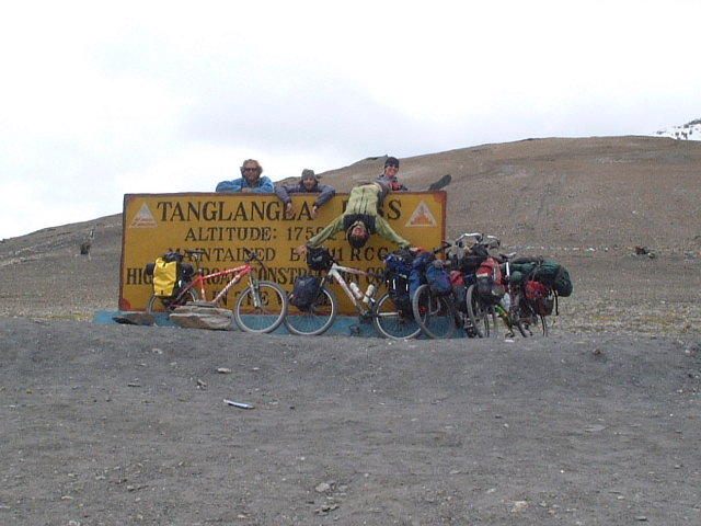
Taglang Pass | 366 | 5360 | 5296 | 5423 | 5360 |
Upshi | 427 | 3432 | 3432 |
|
|
LP | 472 | 3252 | 3252 |
|
|
Leh | 478 | 3561 | 3560 | 3562 |
|
Khardung Pass | 515 | 5327 | 5312 | 5342 | 5514 |
Khardung | 547 | 4036 | 4036 |
|
|
Khalsar | 571 | 3324 | 3324 |
|
|
Deskit | 590 | 3245 | 3288 | 3201 |
|
Leh-Tso Moriri-Manali Distance/Altitude Chart
Location |
|
| Distance | Altitude Processed | Avocet | GPS |
|
|
|
|
|
|
|
Leh |
|
| 0 | 3561 | 3560 |
|
LP |
|
| 6 | 3252 | 3252 |
|
Upshi |
|
| 51 | 3432 | 3423 |
|
Churnathang |
| 141 | 4016 | 4016 |
|
Mahe Bridge |
| 163 | 4136 | 4136 |
|
Bifurcation Tso Moriri/Tso Kar | 176 | 4356 | 4356 |
|
Namshang Pass |
| 188 | 4739 | 4756 | 4721 |
LP |
|
| 196 | 4620 | 4620 |
|
Hill |
|
| 200 | 4684 | 4684 |
|
Tso Moriri - North end | 211 | 4541 | 4503 | 4578 |
Hill |
|
| 222 | 4684 | 4684 |
|
LP |
|
| 226 | 4620 | 4620 |
|
Namshang Pass |
| 234 | 4739 | 4756 |
|
Bifurcation Tso Moriri/Tso Kar | 246 | 4356 | 4356 |
|
Polokong Pass |
| 267 | 4940 | 4916 | 4964 |
Tso Kar |
|
| 282 | 4563 | 4524 | 4601 |
Manali - Leh Road |
| 304 | 4660 | 4660 |
|
Moore Plains End |
| 339 | 4752 | 4752 |
|
Pang LP |
|
| 346 | 4500 | 4464 | 4535 |
Lachulung Pass |
| 367 | 5095 | 5032 | 5158 |
LP |
|
| 373 | 4720 | 4720 |
|
Nakee Pass |
| 378 | 4903 | 4888 | 4917 |
LP |
|
| 396 | 4200 | 4200 |
|
Sarchu |
|
| 421 | 4313 | 4300 | 4325 |
Baralacha Pass |
| 452 | 4870 | 4872 | 4868 |
ZZ Bar |
|
| 474 | 4071 | 4072 | 4070 |
Darcha |
|
| 500 | 3344 | 3344 |
|
Keylong |
|
| 528 | 3096 | 3096 |
|
Tandi LP |
|
| 536 | 2888 | 2888 |
|
Rohtang Pass |
| 594 | 3975 | 3952 | 3997 |
Manali |
|
| 646 | 2050 | 2050 |
|
Lahaul-Spiti-Kinnaur Distance Chart
Kilometre Distances (NB: This guy rode Manali-Lahaul-Spiti-Kinnaur) Kullu- Manali (50) - Rohtang Pass (3980m, 51) - Gramphoo (11) - Chhatru (17) - Chhota Drara (17) - Batal (15) - Kunzum Pass (4600 m, 12) - Losar (19) - Kaza (57) - Tabo (47) - Yangthang (56) - Recong Peo (103) - Rampur (82) - Narkanda (64) - Shimla (64)
Total KM from Rohtang to Shimla: 615 km
Leh-Manali Chart (altitude, distance and road surface, as of 1997)
http://www.betzgi.ch/hoehenrausch/route.html?faktor=100&start=1#d
http://www.betzgi.ch/hoehenrausch/route.html?faktor=100&start=2#d
(From Peakware.com)
Climbing Stok Kangri
Fact Box |
Elevation (feet) | 20082 |
Elevation (meters) | 6121 |
Location | LADAKH
Asia |
Best Climbing Months | July, August |
Easiest Summit Route | Basic Snow/Ice Climb |
Stok Kangri can have snow and ice or not. The climb is not extremely steep but the last bit (1 hour before summit) it gets steeper; the path is narrow and a little exposed. Hands are not needed when Stok Kangri is climbed.
(From Summitpost.org)
Having the Indus Valley already on a considerable altitude, many mountains around here exceed 6000 m easiely.
One of it is Stock Kangri and its twin Golep Kangri. You can get to the base of Stock Kangri by bus or by taxi, which will take you about an hour. In one day you hike up to the saddle between the two peaks, which is on approx. 5200 m. It might makes sense to hire a local guide and a couple of mules or donkeys, as it's sometimes critical to find the correct of all the scattered valleys. Additionally, it's quite reasonable to bring a tent, food and a stove with you, which is easier to carry on a mules back.
From there you can climb up the either Stock Kangri or Golep Kangri by using ice axe and crampons. From both of the summits you'll have a great view over Indus Valley, Zanskar and to the near Chinese and Pakistan mountains. The decent back to the base should be possible in one day.
If you intend to climb both of the Kangri-twins it's reasonable to climb the easier Golep Kangri (approx. 6100 m) first. After decent to the BC, enjoy the rest of the day in the deserted surroundings. You'll be perfectly acclimatised when you head for Stock Kangri the next day.
Stock and Golep Kangri are perfect objectives for fit trekkers without advanced climbing experience who want to summit on their first Himalayan Peak. It is one of the main peaks of the Zansker range.
The route over the South Ridge of Stock Kangri is straightforward, challenging and interesting. On a clear day you'll get great views of the Karakoram Range provided, sometimes even K2 in the far distance.
( More "About the peak" photos/images All Stock Kangri photos/images )
Check out some great photos to get a feel for the climb and the scenery.
http://www.photojenic.co.uk/home-page/stok-kangri-pano.html
http://home.versatel.nl/mauricevanmeteren/Ladakh_2001/html/Stok-Kangri-11.html
From the Thorn Tree: “It is not technically difficult - there is a flat glacier to cross with no crevasses and slope&ridge of snow and scramble. So late it might be even not necessary to use crampons and ice axe but bring it anyway (you can rent that in Leh). It is altitude that turn most people back so be well acclimatized. It is good to do a trek before crossing as many high passes as possible, spending nights on as high altitudes as possible.
It is very close to Leh - you can reach base camp from Leh in one day and next day you are on the top and back in Leh if you are fit and well acclimatized. It is more comfortable to do it in 3 days. It is also possible to have another camp just below summit (ABC).
Formally it is a trekking peak but it seems nobody cares about permit, not even local agencies.”
“Stok Kangri is a technically easy climb but you do need crampons & an ice axe. Plastic boots would be preferable also. You can get an unofficial guide fairly cheaply in Leh. You should be able to rent all of the above equipment also. It´s possible to do the climb in 3 days but most people take 4. Officially you need a permit for this hill which is expensive but if you go with a local guide & are discreet you should be able to do it without one. You can arrange pack horses in Leh. Doing one of these treks & hanging out in Leh for a bit should ensure you are acclimatised. 2 short days will take you up to a campsite on grass at about 5200 metres. You can camp higher but that would be on snow. From the 2nd campsite you go up a huge snow ramp to a ridge at about 6000 metres & then along a snow & rock ridge to the summit. There were no crevasses when I was there.”
Trekking Route/Itinerary:
http://www.pocketsprocket.com/Routes/kargildarcha.html This is from a cyclist who hired ponies to carry bikes from Padum to Darcha. He paid Rs 250 (US$ 5) a day for a pony man and 3 ponies.
From a commercial trekking group’s website,
http://www.razdanholidays.com/high-adventure/zanskar-trek-padum-to-lamayuru.html
these are two treks (in reverse direction than we will go) from Darcha (on the Manali-Leh road) to Padum (capital of Zanskar, midpoint of the trek) and then from Padum to Lamayuru. From Darcha to Padum, they take 9 days of trekking and 1 day for a side excursion to a monastery. From Padum to Leh, they take 10 days (including 2 half days). I think that it’s not unreasonable that we will go faster (15 days rather than 19) as we are fitter and will be more acclimatized than the typical commercial trekking client. Remember that we won’t be carrying heavy luggage, so we will have winged feet! Unfortunately, since we’ll have pony men with us, we’ll have to negotiate and insist on the schedule that we want.
Darcha-Padum
: Day 1 :: Darcha/Chalang Tokpo (Trek)
Morning after breakfast start trekking to reach Chalang Tokpo (3580M) in about 5-6 hours. This day's trek is eassy and Gradual all the way. Overnight stay in tents.
Day 2:: Chalang Tokpo/Zanskar Sumdo/Ramjak (Trek)
Morning after breakfast start an easy trekking to Zanskar Sumdo (3750M). Proceed to Ramjak., total trekking time is approx. 7-8 hours. Overnight stay in tents.
Day 3 :: Ramjak/Chumikanakpo (Trek)
Morning after breakfast start trekking to reach Chumikanakpo (4060 in about 5-6 hours. Climb steeply immediately after the Campsite and then climb gradually up to Chumikanakpo. Arrive and overnight stay in tents.
Day 4 :: Chumikanakpo/Shingola/Lakonng (Trek)
Morning after an early breakfast start trekking 16 Kms to reach Lakong (4100M) by crossing Shingo La 5100m). The climb to the pass is not difficult but climbing down is quite steep through the Glacier. The day is quite long and Tiring, 7-8 hours approx. Arrive and overnight stay in tents.
Day 5 :: Lakong/Kurgiak (Trek)
Morning after breakfast start trekking to reach Kurgiak (4060 M) by covering approx. 14 Kms, 6-7 hours approx. Now you will find the difference in the features of the mountains as you are in Zanskar, Arrive and overnight in stay tent.
Day 6 :: Kurgiak/Purne (Trek)
Morning after breakfast start trekking to reach Purne (3745M) trek for about 5-6 hours. Arrive and overnight stay in tents.
Day 7 :: Purne/Phuktal Gompa/Purne (Trek)
Morning after breakfast start trekking for an excursion to Phutkal Gompa which in one the most impressive Gompas in Ladakh by covering approx 14 kms. Return back to purne and overnight stay in tents.
Day 8 :: Purne/Ichar (Trek)
Morning after breakfast, cross small Canyons of Pudding stones, which leads to Char village and passing Hanumi and Surle villages. Arrive at Ichar, 5-6 hours approx. Overnight stay in tents.
Day 9 :: Ichar/mone (trek)
Morning after breakfast start trekking to reach Mone (3650 M) 5-6 hours approx .Arrive and overnight stay in tents.
Day 10 :: Mone / Padum (Trek)
Morning after breakfast start trekking to reach Padum (3560 M), 5 - 6 hrs approx. Padum is the old capital of Zanskar. Arrive and overnight stay in tents.
Padum-Leh (usual route):
Day 1 :: Padum/Karsha (Trek)
Morning after breakfast start your first day's trek to Karsha (3610 M) by covering approx. 7 kms in 3-4 hrs crossing the Doda river. A 15th century Gelupa Monastery (popularly known as Karsha Gompa) dominates the scene. Arrive and overnight stay in tents.
Day 2 :: Karsha/Pishu (Trek)
Morning after breakfast start trekking to Pishu (3665 M) by covering approx. 13 kms in 4-5 along the river Zanskar. Arrive and overnight stay in tents.
Day 3 :: Pishu/Hanumil (Trek)
Morning after breakfast start trekking to reach Hanumil (3960 M) by covering approx. 14 kms in 4-5 hrs through Pidmu after continuing to the left bank of river Zanskar. Arrive and overnight stay in tents.
Day 4 :: Hanumil/Purfi La/Snertse (Trek)
Morning after breakfast start trekking to reach Snertse (3745 M/15 kms). After crossing a steep and difficult climb to the pass, Purfila (3900 M). From the pass it is a steep descent upon Omachu river and from there it is about one km climb upto a wonderful Campsite at Snertse. Arrive and overnight stay in tents.
Day 5 :: Snertse/Hanumala/Lingshet (Trek)
Lion's pass which is also the highest pass on this trek. First the climb is through the terminal Moraine and then through the long Glacier. The climb is not steep but the Descent through the steep Glaciers a little difficult. Proceed to Photoksar via another pass called Boumitse La (4200 M). The day is quite long and Tiring, 7-8 hours approx. Photoskar village is a town of clusters of Homes, Green Fields, and a Gompa above in a dark brown cut crop. Arrive and overnight stay in tents.
Day 6:: Lingshet / Foot of Shingla
Early morning after breakfast start trekking to the base of Singla, 6 - 7 hrs approx. Dinner & overnight in camp.
Day 7 :: Foot of Shingela / Shingela / Photoksar (Trek)
Early morning after breakfast start climb up the Shingela Pass (5230 M) which takes about 2 hours. Shingela means the lion's pass which is also the highest pass on this trek. First the climb is through the terminal Moraine and then through the long Glacier. The climb is not steep but the Descent through the steep Glaciers a little difficult. Proceed to Photoskar village is a town of clusters of Homes, Green Fields and a Gompa above in a dark brown cut crop. Arrive dinner & overnight stay in tents.
Day 8 :: Photoksar/Sirsir La/Hanupatta(Trek)
Morning after breakfast start trekking (6-7 hours approx.) to reach Hanupatta (3770 M) after crossing Sirsir La (4230 M). The climb to the pass is steep but the descent is gentle. Arrive and overnight stay in tents.
Day 9 :: Hanupatta/Wanla or Shila (Trek)
Morning after breakfast start trekking (6-7 hours approx.) to reach Wanla (3645 M). Wanla is a small town with its Maroon and white Monastery Perched above the town on a knife edged ridge. Arrive or proceed to Shila (about 30 minutes easy walk which is another nice camping site) and overnight stay in tents.
Day 10 :: Wanla/Lamayuru
Morning after breakfast start trekking (4-5 hours approx.) to reach Lamayuru (3510 M). Lamayuru Gompa is one of the most impressive and well maintained monasteries in Ladakh. Arrive and visit Monastery.
Padum-Leh (alternate, remote route via Cha Cha La):
Taken from http://www.greatindianoutdoors.com/trekking/zanskar.htm
This one might not be possible in August because rivers will be at their highest, and there are several river crossings that might be lethal then. It would be a nice trek, though, through amazing canyon country.
Day 1: Padum - Zangla: 20 km, 7 hrs
Highlights: Crossing the Tsarap River Bridge & The Karsha Gompa
Day 2: Zangla - Local Village (Sumdo): 9 km, 3 hrs
Highlights: Multiple River crossings & The Zulung Valley
Day 3: Sumodo - Intermediate Camp: 16 km, 6 hrs
Highlights: The Cha cha la (4950 mts) that offers superb views of the Himalayan Range Beyond Padum.
Day 4: Campsite - Tilat Sumodo: 17 km, 7 hrs
Highlights: Crisscrossing the river and some wildlife.
Day 5: Tilat Sumodo - Base of Rubang la: 17 km, 6 hrs
Highlights: The Khampa Nomads with their Hundrends of Yaks & Horses.
Day 6: Base of Rubang la - Markha: 17 km, 6 hrs
Highlights: Rubang la (5020 mts) offers awesome views of the Stok range, the First glimple of Markha Valley.
Day 7: Markha - Thochuntse: 12 km, 5 hrs
Highlights: Part of the Zanskar gorge, Markha river crossings
Day 8: Thochuntse - Nimaling: 7 km, 3 hrs
Highlights: The Nimaling Plains & the Mani walls and Chortens that dot the trail. Also a side trip to the base of the Kangyaze peak (6000 mts) is possible.
Day 9: Nimaling - Sumodo: 18 km, 7 hrs
Highlights: Too many! The Kongmaru la (5150) highest pass on the trek, bird's eye view of the Ladakh and Indus Valley, Kangyaze peak in full majesty
Day 10: Sumodo - Hemis - Leh : 10 km, 3 hrs
Highlights: The Hemis Monastery & National park


